Saturday, May 7, 2011

Chapter 18: Hawaii

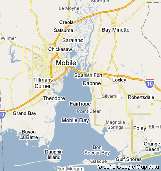
Gulf Shores, Alabama
Like Hawaii, the state of Alabama depends on its beaches. Alabama's coastline, home to the beaches of the Gulf of Mexico, is an important part of the quality of life for many of the state's citizens and one of the state's greatest economic and environmental assets. The white, sandy beaches of the coastal towns of Orange Beach and Gulf Shores and Dauphin Island are beloved and popular vacation destinations for Alabamians and out-of-state tourists. The fine quality of the sand and gentleness of the surf make for some of the prettiest beaches in the world and are the top tourist destination in the state. Alabama's shoreline along the Gulf of Mexico stretches for 60 miles. The tidal shoreline that borders all of the coastal bays, rivers, and bayous in Mobile and Baldwin counties extends another 600 miles, with the shoreline around Mobile Bay accounting for about 100 of those miles.
Beautiful white sand in my hand last year at Gulf Shores


Although human activity has played an important role in the history of the Alabama shoreline, it was created primarily by hundreds of thousands of years of geology. It was during the last 10,000 years, however, that sea levels rose to their present-day elevation. Sea level fluctuations, waves, erosion, and deposition are among the many geologic processes that continue to shape the modern Alabama shoreline. Alabama's Gulf beach sands, which are composed almost entirely of quartz grains, washed out of the ancient Appalachian Mountains hundreds of thousands of years ago. Subsequent sorting by waves and sea level fluctuations have resulted in practically uniform sand grains, accounting for the high quality of the sand on the beaches. Because of their constant exposure to breaking waves, wind, and storms, coastal shoreline environments, including Alabama's, are in a constant state of change and are usually being either eroded or built up. Breaking waves move tons of sand along the Alabama coast through a process known as "littoral drift." The dominant direction of this sand movement is from east to west, but sand moves west to east on occasion, as well.

Erosion is a topic of concern for Alabama’s beaches, also mentioned in this chapter about Hawaii. The location, and look, of almost all of the Alabama shoreline has been affected by human activity. These actions include infilling of wetlands, construction of bulkheads along the bay shorelines to serve as protective barriers to wave erosion, reconstruction of the Gulf beaches, and, primarily, engineering and dredging passes for ship channels. These manmade waterways are a primary cause of Alabama's beach erosion. Since 1960, more than 20 million cubic yards of sand have been removed from the beach, or littoral, system, by the dredging of Mobile Pass for the Mobile Ship Channel. Another 3 million cubic yards of sand have been dredged from the Perdido Pass Channel. The removal of these tremendous volumes of sand has resulted in severe beach erosion in the state during the past several decades because the dredging removes sand that would normally have moved down the coast and been deposited on Alabama's beaches. The solution to Alabama's Gulf beach erosion problem is two-fold. One approach is artificial sand bypassing, a process by which dredged sand is relocated to the beaches where it naturally would have been deposited. The second is a process known as beach nourishment, which involves adding large amounts of good-quality sand to beaches to widen them. This process can be used to rebuild beaches damaged in previous decades. The first major beach nourishment project in Alabama was undertaken by the city of Gulf Shores along two and a half miles of the central business district in 2001, at a cost of approximately $6 million. It was so successful that subsequent projects were implemented to enrich another 14 miles of shoreline extending through the city of Orange Beach. These engineered beaches have been successful in two ways. First, they have saved the Gulf Shores beach that was being squeezed out between the Gulf erosion and the seawalls protecting beachfront condominiums. Second, they have reduced the damage to infrastructure, including roads and condominiums, when hurricanes have hit the coast.


Erosion in Gulf Shores

 Sources:

http://www.encyclopediaofalabama.org/face/Article.jsp?id=h-2049


Chapter 16: The North Pacific Coast

Like the Pacific Northwest region, Mobile is wet with a high moisture content in the air. While I have discussed this in previous posts, I have found more scientific information as to why exactly it is so wet in Mobile. The influence of the Gulf of Mexico is possibly the second-most important factor in determining Alabama's climate patterns. In addition to serving as a source of moisture, this large body of warm water stores energy absorbed from the Sun throughout the year, which helps moderate temperature patterns along the coast. This influence on local temperature patterns is commonly known as the Maritime Effect. In summer, a large mass of warm, moist air, known as a maritime tropical air mass, moves northward from the Gulf of Mexico and dominates daily weather patterns in Alabama. In autumn, the polar jet stream begins to migrate southward and directs cool, dry air masses, known as Continental Polar air masses, into the state. The leading edge of the continental polar air mass is referred to as a cold front, and these fronts move across Alabama at a rate of about one per week until spring, when the polar jet stream begins to migrate northward. When a cold front moves across Alabama, the cold, dry air forces the warm, moist air of the Maritime Tropical air mass upward into the atmosphere. The moisture in the warm air soon condenses and returns to the surface as precipitation. As the cold front passes overhead, the cold, dry air mass moves into the region and dominates daily weather patterns for several days. Cold, sunny weather usually prevails until the next cold front moves into the region. The precipitation that normally occurs when the cold front passes is usually in the form of intense rainfall.


Mentioned in the chapter, The North Pacific Coast region produces the most pulp for paper products outside of the southeast. Mobile is no stranger to paper product production itself, containing many paper mills. The southwestern area of Alabama's Coastal Plain, encompassing Mobile, Baldwin, Escambia, and Monroe counties, is the heart of the state's timber industry. Pine plantations cover much of the rural land, producing timber for local pulp and paper mills and other wood-products industries. Wildlife management, hunting, and recreation associated with forests have become an important source of revenue for some land owners. International Paper and Kimberly-Clark both have paper mills in Mobile.

Sources:  


http://www.encyclopediaofalabama.org/face/Article.jsp?id=h-1396
http://www.encyclopediaofalabama.org/face/Article.jsp?id=h-1283

Tuesday, May 3, 2011

Chapter 15: California

Having grown up in Mobile, and spending the last 7 years here in Cali, I can most assuredly tell you that the similarities between these two worlds are few and far between!  There aren’t really any earthquakes – although there was a 3.5 magnitude that hit along the Alabama gulf coast February 5 of this year – and there has been no rush to pan for gold in my hometown.  Like LA however, Mobile is the county seat and there are many outlying “cities” and towns that are included in the Mobile area.  Bayou La Batre, Chickasaw (where my mother was born), Citronelle, Creola, Prichard (one of the top 25 most dangerous cities in the country), Saraland, Satsuma and Semmes are some of the incorporated cities of Mobile.  Dauphin Island and Mount Vernon are towns, while Grand Bay, Theodore and Tillman’s Corner are all census-designated places – and also where my home is closest to.  Other unincorporated communities include Chunchula, Coden, Eight Mile, Irvington and St. Elmo.  Until this posting, I suppose I had never realized how many Native American names we have for these cities!


Although Mobile is spread out, it does have a center. Downtown Mobile is the economic and cultural hub of the central Gulf Coast, a city with a future as exciting as her past. Ships from around the world sail into her port carrying goods and visitors, world class entertainers grace her stages and emerging artists exhibit works in galleries both expansive and intimate. This creative and economic energy is contributing to the revitalization of this 300 year old city; a city of great charm, rich diversity and dynamic ideas. The escalating pace of the redevelopment of Downtown Mobile is unmistakable, as skyscrapers take shape next to historic renovation and young people flock back to this urban area, looking to live in the historic houses of midtown and downtown Mobile.
Dauphin Street in downtown Mobile, the place to go for great food and good nightlife


Sources:

Chapter 14: The Southwest Border Area: Tricultural Development

There are not very many comparisons when relating Mobile with this region, however there has been a spike in immigration to this area recently.  Historically, Alabama has had very low levels of immigration.  Only 15,000 immigrants lived in state at the turn of the 20th century, making up less than one percent of the total state population.  In 1990, the number of immigrants nearly doubled.  By 2000, approximately 90,000 immigrants were living in the state, increasing again to 137,000 by 2007, a 56% growth rate.  Alabama ranks fifth in the rate of immigrant growth among all states this decade.  These immigrants largely filled low-wage, non-union jobs. For Alabama, the 25-year period between 1980 and 2005 brought a wave of new immigrants who were part of a much larger surge of immigration that has now surpassed in numbers even the huge European migrations of the industrial era. A new wave of Hispanic immigration to the southern United States developed during the 1980s and after, primarily in response to new federal immigration legislation passed in 1986. This migration has resulted in the creation of substantial communities of Spanish-speaking people in Alabama. Most of these immigrants have met labor demands in farming, industry, construction, landscaping, and the service industry. Although fewer in number, Hispanic physicians, nurses, engineers, social workers, teachers, business people, and university professors are also among the recent migrants to Alabama. There is no indication that the new immigration pattern is slowing, and Hispanics are bringing economic and social changes to the South, as well as new forms of cultural expression. Immigrants have come primarily from Mexico, with others arriving from Guatemala, Honduras, and other Central and South American nations. Non-Hispanic Alabamians have reacted in varying ways to the new Hispanic migration and its concentration in small towns and urban neighborhoods. This Hispanic influx has complicated Alabama's historic racial divide between black and white. In the late 1990s, anti-immigration sentiment surfaced in a few north Alabama towns with rising Hispanic populations, and African American spokespersons in some areas have complained about job competition from Hispanic workers. Spanish language use has become controversial. Additionally, an unknown number of Hispanics are in the state illegally, perhaps as many as 40 to 50 percent of the total number, and this is a matter of concern to many Alabamians. These problems intensified between 2005 and 2007, as the U.S. Congress debated new immigration legislation, tougher border controls, and guest-worker programs for undocumented immigrants. Alabama politicians have pushed stronger immigration controls as well, helping to politicize the immigration issue. Meanwhile, big employers in poultry, construction, and agriculture have asserted their dependence on Hispanic workers. Rallies for and against immigration occurred throughout the state in 2006. Alabama has fewer than a dozen immigration or U.S. Border Patrol agents, and they concentrate their efforts on undocumented residents who are arrested by local law-enforcement agencies and charged with felonies.
Mobile is also like the Southwest Border area in that it also has a higher poverty rate.  The poverty rate in Mobile County, Alabama has increased by 1.3 percent from the rates reported in the Decennial Census, moving from 18.5 percent to 19.8 percent.
Three Eagle Scouts, the first produced by the Greater Alabama Council's Hispanic Outreach program


When compared to other counties (and parishes) throughout the United States, Mobile County reported a medium-low median household income of $39,441 (Adjusted to 2005 Dollars). This figure is 1.3 percent lower than the median income in State of Alabama of $39,938 and the median is 24.6 percent lower than the median in the US, which is $49,133. Contrasted against to other counties (or parishes) throughout the US, Mobile County, Alabama can be considered to have a relatively high rate of poverty among the people, accounting a rate of 18.5 percent of the population with family incomes below the 1999 poverty level.


Sources:


Monday, May 2, 2011

Chapter 13: The Empty Interior

While the Empty Interior may be empty to us regarding population, it supports a diversified, growing, and sometimes controversial wildlife population.  This region contains species such as the bison, the North American elk, the pronghorn antelope, the white-tailed deer and wild turkeys.  While Mobile does not contain most of these species, it does support a diverse wildlife population also.  In fact, Alabama ranks fourth in the nation for its biological diversity. There are more than 800 species of vertebrate animals and 3,400 plant species in the state. Alabama's terrain makes it an ideal site for wintering fowl who seek the warmth of the southern climate. Its southern swamplands give refuge to the alligator, and its forested region and bayous are home to a varied array of wildlife.  Beaver colonies are prevalent in the swamplands and ducks, geese and other water fowl winter in the area. Alligators can be found in some southern swampland regions. Animals that can be found throughout Alabama include deer, foxes, minks, bobcats, opossums, rabbits, raccoons, squirrels, skunks and wild turkeys. Freshwater fish include bass, buffalo fish, crappie, catfish, shad and garfish. Along the coast there are crabs, shrimp, oysters, mackerel, red snapper, tarpon, drumfish, flounder and mullet.  Alabama has 93 native reptiles, which include the alligator, 12 lizards, 31 turtles and 48 snakes. The state has 73 native amphibians, which include 43 species of salamanders and 30 species of frogs. The exotic greenhouse frog can be found in Mobile and Baldwin counties within the state. There is more mussel diversity in Alabama than any other state, and there are 83 species of crayfish, also more than any other state. Alabama has aquatic snails, yet land snails are rare. Alabama has 62 native mammals and over 300 species of fish, and some 420 species of birds. 
Greenhouse Frog


USS Alabama
With a name like the Empty Interior, it is surprising to learn that it generates a lot of money each year in tourism…until you realize that Las Vegas is located in this region!  Mobile, while not quite a destination hotspot like Vegas, does have many fun and beautiful tourist attractions.  One of the most memorable sites any visitor remembers about Mobile is the USS Alabama battleship.  Alabama was commissioned in 1942 and served in World War II in the Atlantic and Pacific theaters. She was decommissioned in 1947 and assigned to the reserve duty. She was retired in 1962. In 1964, Alabama was taken to Mobile Bay and opened as a museum ship the following year. The ship was added to the National Historic Landmark registry in 1986.  Visitors are allowed to view the inside of the main gun turrets and anti-aircraft guns. The powder magazine was opened to the public through some holes that were cut, and stairs put in. The bunk of Major League Baseball Hall of Famer Bob Feller is marked for those touring. Feller served on Alabama for several years during World War II.  In recent years, Alabama has been occasionally used as a hurricane shelter. During Hurricane Katrina, Alabama suffered damage which resulted in an eight-degree list to port, and shifting at her permanent anchorage. (The families of 18 museum employees were aboard during Katrina.) In addition, the Aircraft Pavilion was severely damaged, with three of the exhibited aircraft destroyed. At the end of 2005, damage estimates were in excess of four million dollars. The park reopened 9 January 2006, with the ship having a three-degree list (which was still being corrected). The battleship, submarine, and Aircraft Pavilion are all open.  My favorite tourist attraction, and a place my mother and I went to every Spring Break, is Bellingrath Gardens.  Bellingrath Gardens and Home was the creation of Mr. and Mrs. Walter Bellingrath.  The Gardens first opened to the public in 1932 while a national garden club meeting was taking place in Mobile.  Mr. Bellingrath placed an ad in the Mobile paper, announcing that anyone who would like to see the spring garden could do so free of charge.  After an overwhelming response, the couple decided to keep the gardens open year-round, beginning in 1934. Throughout the year, this 65 acre Garden Estate is in full bloom with camellias in the winter, azaleas in the spring, roses in the summer, chrysanthemums in autumn and Magic Christmas in Lights during the holiday season.
Azaleas in bloom at Bellingrath
Bridge in the Oriental Garden at Bellingrath

Sources:

Chapter 12: The Great Plains and Prairies

As we learned in Chapter 12, much literature, songs and folktales have been dedicated to the grasslands of the Great Plains and Prairies.  Like this region, much has been written and sung about Mobile as well.  Perhaps the greatest known piece of our time is a novel by Mobilian Winston Groom called Forrest Gump.  Of course, everyone knows the movie, but in the novel, Forrest actually grows up in Mobile, not Greenbow.  Immortalized onscreen by Tom Hanks, Forrest Gump experiences adventures ranging from shrimp boating and ping pong championships to thinking about his childhood love. The Vietnam War and college football are all part of the story. Throughout his life, Gump views the world simply and truthfully. Throughout the course of the book, he really doesn't know what he wants to do in life. Author and narrator Groom uses intonations that capture Gump's personality. Gump is full of wisdom, but is considered an "idiot" because of his low IQ and disability. According to him, he "can think things pretty good", but when he tries "sayin or writin them, it kinda come out like Jello". He is also physically strong and falls into amazing adventures.  Many iconic scenes in the movie take place in Bayou La Batre, Alabama, a small shrimping town in Mobile County, fifteen minutes south of my home.


Many of the Great Plains Indians are actually displaced Native Americans from Mobile.  My great-grandfather in fact is a Creek Indian, also known as the Muskogee.  The Creek or Creeks, are a Native American people traditionally from the southeastern United States.  Mvskoke is their name in traditional spelling. Modern Muscogees live primarily in Oklahoma, Alabama, Georgia, and Florida.  They were descendants of the Mississippian culture peoples, who built earthwork mounds at their regional chiefdoms located throughout the Mississippi River valley and its tributaries. The historian Walter Williams and others believe the early Spanish explorers encountered ancestors of the Muscogee when they visited Mississippian-culture chiefdoms in the Southeast in the mid-16th century.  The Muscogee were the first Native Americans to be "civilized" under George Washington's civilization plan. In the 19th century, the Muscogee were known as one of the "Five Civilized Tribes", because they had integrated numerous cultural and technological practices of their more recent European American neighbors. In 1811, the Shawnee leader Tecumseh, with the help of a prophetic comet and earthquake, convinced the Muscogee to resist the efforts of civilization. The Red Stick War, begun as a civil war within the Muscogee Nation, enmeshed them in the War of 1812.  During the Indian Removal of 1830, most of the Muscogee Nation moved to Indian Territory. The Muscogee Creek Nation based in Oklahoma is federally recognized, as is the Poarch Band of Creek Indians of Alabama. Creek tribe communities also have formed in Louisiana and Texas.
Creek Indians

Sources:

Chapter 11: The Agricultural Core

In the chapter covering the Agricultural Core, an important factor in this region’s ability to provide the country with much of its produce is its soil type, including alfisols, mollisols and alluvial soils.  In Mobile, located in the outer belt of the Coastal Plain, also called the Timber Belt, the soil is sandy and poor, but responds well to fertilization.  The majority of the soil in the coastal plains of Alabama comes from marine and fluvial sediments that eroded from the Appalachian and Piedmont plateaus. The subsoil in the coastal plains is either loam or clay and the surface soil is either sandy loam or loam. Smithdale, Luverne and Savannah soils dominate the tipper Coastal Plains, while Dothan and Orangeburg soils dominate the Lower Coastal Plains. 
The Agricultural Core’s natural network of waterways permits easy and inexpensive shipment of farm goods to markets and to the countries’ main international trade ports.  Mobile’s waterways have also been integral to its trading and key location as a port.  The Mobile Delta consists of approximately 20,323 acres of water just north of Mobile Bay. Second only to the Mississippi River Delta in size, the Mobile Delta is an environmental showplace that is 30 miles long and 12 miles wide. It covers more than 200,000 acres of swamps, river bottomlands and marshes. Congress named the Mobile Delta a National Natural Landmark in 1974; fewer than 600 sites have received that honor. The Alabama Environmental Council considers the Delta as one of "Alabama's Ten Natural Wonders." Formed by the confluence of the Alabama and Tombigbee rivers, the Mobile Delta is a complex network of tidally influenced rivers, creeks, bays, lakes, wetlands, and bayous.

Monday, April 18, 2011

Chapter 10: The Southern Coastlands: On the Subtropical Margin

Chapter 10:  The Southern Coastlands:  On the Subtropical Margin

Yes, Mobile is located in the Southern region, but its microregion is the Southern Coastlands, the area discussed in Chapter 10.  I have addressed Mobile's subtropical, humid climate that is very different from the rest of our country in previous posts.  This climate not only extends the growing season, it also attracts new residents and visitors.  Unlike its neighboring state of Florida, Mobile does not have a large retirement age group.  In fact, the median age is only 34.3.  If you take a short trip across Mobile Bay however, you will find one of the nicest and most unusual retirement communities in the US in Fairhope, AL.  Although it is located in another county (Baldwin), it is only a half hour drive from downtown Mobile.  Retirees are attracted to this little city because of the temperate climate and low crime rate.  With a population of 14,000, retirees make up over 35% of the population.  I spent much time going “across the Bay” to visit my grandfather (PawPaw) and strolling the downtown streets for beignets and shopping in the quaint stores.  If you drive a little further down to Gulf Shores, AL, located on the Gulf of Mexico, they even have a term for their retired visitors – “Snowbirds.”  These retired Baby Boomers hail from the northern and Midwestern states as well as Canada.  Usually arriving in October, they escape the harsh winter conditions of the north to enjoy a mild winter along the Gulf Coast in condos, RVs or retirement communities.  Hard numbers on how many Snowbirds winter on the Gulf Coast are impossible to find, some estimate more than 100,000 winter along the northern Gulf Coast and numbers are expected to increase over the next decade. 

Delicious beignets from Fairhope I enjoyed over the Christmas holidays!


A retirement community in Fairhope, AL


While the weather, especially in winter months, is very enjoyable, there is a downside to all of that hot, humid air along the Gulf Coast – hurricanes.  When discussing the damage done by Hurricane Katrina, most of the talk covers New Orleans and some about Mississippi, but Alabama suffered greatly from this storm.  Alabama suffered widespread, moderate to heavy damage caused by hurricane-force winds, flooding by a storm tide of 14–18 feet, and tornadoes.  Massive damage occurred along coastal areas, pushing small ships and oil rigs ashore, flooding fishing areas with dozens of shrimp boats, destroying marinas plus hundreds of boardwalks, and swamping beachfront homes or hotels, with widespread tree damage and roofs or shingles torn off. Afterward, 22 counties in Alabama were declared disaster areas for Federal assistance, spanning a 400-mile region.  Mobile Bay spilled into downtown Mobile to the depth of 2–6 feet. A flotel (floating habitat used by oil platform crews) broke loose of its moorings and slammed into the Cochrane-Africatown USA Bridge, the bridge damage was later found not to be critical but in the meantime its traffic was reduced from four lanes to two. There was cause for concern because the bridge, in conjunction with underwater tunnels, is a part of the I-10 Hazardous Materials route across the Mobile River. The Battleship Parkway crossing Mobile Bay was also closed before the storm and was completely submerged during the hurricane. Many coastal homes south of the Point Clear area were severely damaged, flooded, or swept away.  Damage was quite heavy in coastal Alabama, including significant structural damage to buildings. Bayou La Batre, a fishing town 15 minutes from my house in Mobile, sustained significant damage to its infrastructure and fishing fleet. It was the focal point of public attention given to Alabama in the aftermath of the storm. On Sunday, September 4, 2005, U.S. Secretary of State Condoleezza Rice visited a community center in Bayou La Batre and surveyed storm damage with Alabama Governor Bob Riley. My grandmother’s (Nannie) house in the Bayou was blown away from this powerful hurricane.  I was not a resident of Mobile when Katrina hit, but I did visit the Bayou in October of 2005.  The devastation was unlike anything I’ve ever seen in person.  Hundreds of shrimp boats were stacked up on top of each other, 50 yards offshore.  It was such a surreal experience that I didn’t even think to take a picture.  The picture below is one I found on the web, but it does no justice to what I saw a month after the disaster. 


Hurricane Katrina as a Category 5


Shrimp boats in Bayou La Batre, AL after Hurricane Katrina


Sources:


Sunday, March 20, 2011

Chapter 9: The Changing South

Mobile is part of the Changing South, more specifically the Southern Coastlands described in the next chapter. Growing up a Southerner, I can attest to the rich culture and the pride Southerners feel about their region. Although there is an overall general “southern pride,” there is much diversity within the Southern region. When I think of the South, I think of the states Alabama, Mississippi, Louisiana, Georgia, Tennessee and the Carolinas. Kentucky, Arkansas, Texas and Virginia are also considered part of the region, but ask any Mobilian or Alabamian and they will tell you differently. I attribute this to the strong differences between the sub-regions. Although there are differences between Mobile in the Southern Coastlands and say Atlanta in the Piedmont region, we all share commonality and pride in being Southern.

Alabama State Flag
When one thinks of the Old South, plantations dominate public thought. Crops like short staple cotton did well in Mobile - in fact, I had a cotton field across the street from my house growing up - but other southern crop staples like indigo, tobacco and sugar cane did not do well. These plantations were almost always located along rivers so they could transport the raw cotton faster and more cost effectively. The Alabama River was heavily used as it flowed into the port of Mobile. From Mobile, the cotton was shipped to New England and European textile factories.
Oakleigh Mansion, a famous plantation house in Mobile

Vessel License for the Clotilde, circa 1855

Plantations and the South cannot be discussed without mentioning slaves. Because large-scale plantation production required a large amount of labor, the number of slaves in the state grew from almost 48,000 in 1820, to 435,000 in 1860. Most of these slaves worked in cotton production. Although there were plantations in Mobile, the city is more known for being the port from which many of the slaves came through and was the slave trading capital of the state until 1850. In fact, the last known shipment of slaves was brought to Mobile illegally in 1860, more than 50 years after the slave trade had been declared illegal.


Sources:
http://www.encyclopediaofalabama.org/face/Article.jsp?id=h-1832
http://en.wikipedia.org/wiki/Mobile_(AL)

http://en.wikipedia.org/wiki/Africatown

Chapter 8: Appalachia and Ozarks

At first glance, Appalachia and the South have similar characteristics. Both have good land for agricultural purposes, but Appalachian land is better suited for smaller farming. Both had slower development of manufacturing, but Mobile’s urban development has been more successful than most of Appalachia. While Mobile had many immigrants including France, Britain and Spain at the onset, Appalachia was settled mostly by the Germans and Scots-Irish, establishing its Anglo-Saxon population that endures to this day.
Appalachia had good land for small-scale farming, but poorly suited for large-scale agriculture compared to land in the South. This region continued to focus on agriculture long after manufacturing and urban living enveloped the rest of the country. Appalachia had few products to sell and discouraged development. In many small Appalachian counties the black populations are very small. Few new immigrants ever settled here because of little urban development, no antebellum plantation economy like the South and had limited agricultural land. Appalachia remained unchanged in a nation where immigration, education and commerce were the norm.

Tennessee farm
Like Mobile, Appalachia is mostly Protestant, but is mostly Anglo-Saxon and white, whereas Mobile is about half white and half black, as mentioned in a previous post. In fact, Appalachia is the nation’s largest predominantly white, low-income region according to the book. Like Mobile, the people of Appalachia are conservative both politically and religiously. Appalachia is also included in the Bible Belt with Mobile. Although Mobile and Alabama as a state have roots in the Democratic party, the city and state are now red states. Appalachia differs from the South in that the region’s roots have always been solid with the Republican party.

Results from the 2000 Presidential Election.  Appalachia and Ozark states (Missouri, Arkansas, Pennsylvania, West Virginia, Tennessee, and parts of Georgia and Alabama) are all red states.
When one thinks of the people of Alabama and the South, the term “redneck” is often used to stereotype its people. Appalachia also experiences a similar stereotype in the word “hillbilly.” Because of their isolation and poor economic opportunities, people of the Appalachian region have often been considered rural. Their people tended to stay in the same place they were born and their increasing conservative religious beliefs, furthered this stereotype. Today, most of this isolation is gone, but many of the values - and stereotypes - endure.

Saturday, March 19, 2011

Chapter 7: The Bypassed East


Red Snapper
Largemouth Bass
Chapter 7 discussed the Bypassed East, a part of the country that is much different than the Southeast where Mobile is located. Although the Appalachian Mountain chain begins in northern Alabama and stretches up to the Bypassed East, the “northern Appalachians’ structure bears little surface resemblance to the southern Appalachians,” according to the book. This region is also very cold and though it has a lot of precipitation like Mobile, the rocky soil and hilly terrain inhibits farming, unlike Mobile’s rich agricultural fields. The continental shelf of the Bypassed East however, sees much growth. Because its waters are shallow, it allows the sun to penetrate the waters, allowing for plankton growth. Because plankton is a basic source of food for fish, cod and halibut - cold water fish - were abundant. Fishing is still important to the region, but pollution and over fishing have challenged the industry. The fishing industry is very important to Mobile and Mobile has a rich history of diversity in its freshwater and saltwater locations in river systems, lakes and the Gulf of Mexico. The official freshwater fish of Alabama is the Largemouth Bass, but many other species of freshwater fish are equally sought. These species include the spotted bass, crappie, brim, stripe and catfish. The official saltwater fish of Alabama is the Tarpon, but many other species are popular including red snapper, flounder, sailfish, grouper and amber jack. The fisheries in Alabama are thriving, but the Deepwater Horizon oil spill last year definitely put them in peril. The shrimp and oyster industry have suffered because of this pollution and I fear that the Gulf will never be the same again.

Oil washed ashore at Orange Beach
A dolphin my friend pulled from the Gulf that succumbed to the oil

Chapter 5: The North American Manufacturing Core


The USS Independence at Austal USA on Mobile River
Although Mobile is not included in North America’s Manufacturing Core and has mostly been considered a port city, it has become known for manufacturing in recent years. Aerospace, retail, services, construction, medicine, and manufacturing are Mobile's major industries. After experiencing economic decline for several decades, Mobile's economy began to rebound in the late 1980s. Between 1993 and 2003 13,983 new jobs were created as 87 new companies were founded and 399 existing companies were expanded. 1,700 new jobs were created from February 2003 to February 2004. Mobile's Alabama State Docks underwent the largest expansion in its history by expanding its container processing and storage facility and increasing container storage at the docks by over 1,000% at a cost of over $300 million, thus positioning Mobile for rapid container processing growth. As of 2008, the Port of Mobile was the 9th largest by tonnage in the United States. In 2005 Austal USA, based in Mobile, expanded their production facility for US defense and commercial aluminum shipbuilding. Austal announced in November 2010, upon winning another multi billion dollar defense contract, it will yet again expand its facilities in downtown, adding over 2,200 jobs. In 2007, German steel manufacturer ThyssenKrupp announced plans for a $4.65 billion steel mill, now in production. It is the largest steel plant in the world with over 1,200 acres under roof at 7.7 million square feet. The Brookley Complex, also known as the Mobile Downtown Airport, is an industrial complex and airport located 3 miles south of the central business district of the city. It is currently the largest industrial and transportation complex in the region with over 100 companies, many of which are aerospace, and 4000 employees on 1,700 acres. Brookley includes the largest private employer in Mobile County, Mobile Aerospace Engineering, a subsidiary of Singapore Technologies Engineering.

Sources:
http://en.wikipedia.org/wiki/Mobile,_Alabama#Economy
 

Chapter 4: Megalopolis

While Mobile can certainly not be considered as a part of the Megalopolis or even a large, metropolitan city, it is the 3rd largest city in Alabama. Many of the characteristics of what made cities in the megalopolis like NYC and Boston so big can also be attributed to the reason Mobile became one of Alabama's largest cities.  As mentioned previously, Mobile's proximity to rivers and the Gulf of Mexico set it up as a major port for Alabama and the South, bringing money and business into the city's coffers. The influx of people that forced land size to increase mentioned in our book also happened in Mobile in the late 1900s, when the city's square mileage tripled.  Although the population grew, there have been no real prolems with congestion due to the influx of people (though it's hard to compare once you've experienced the worst traffic in the WORLD living here!).

In the Megalopolis, skyscrapers and tall building s are the norm, but in Alabama, not so much. Although these buildings are few and far between, Mobile is actually home to the tallest building in Alabama and along the Gulf Coast, save Houston. The RSA Tower in downtown Mobile, began construction in 2003. It now houses 25 office floors, 3 lobby floors, 4 hotel floors, and 1 service floor, together with 20 elevators and 570,000 square feet (52,955 m2) of column-free floorspace.[1] The lighted crown is visible from 30 miles (48 km) away along Mobile Bay on a clear night.[2]


Sources:
http://en.wikipedia.org/wiki/RSA_Battle_House_Tower

Chapter 3: Foundations of Human Activity

Chapter 3 discusses the native peoples of different regions and the pattern of different nationalities of people affected settlement. One need only research the derivation of the name Mobile to learn that this word is a Choctaw Indian word Mauvilla meaning "paddler." Many Native American influences can be seen in Mobile and the state of Alabama, from the names of rivers and cities like Mobile and Tuscaloosa, to the reservations that dot the area like the Creek reservation in Atmore where my great grandfather was a chief.  Upon exploration in the 1500s, Spanish explorers discovered many native tribes in the area, some of whom burned down their villages and fled upon discovery.

As mentioned in a previous post, Mobile has flown six flags, 3 of which were foreign - France, Britain and Spain. The early to mid 1700s saw Mobile under French rule, serving as the capital of the first Feench colony of Louisiana, founded by the brothers Pierre le Moyne d'Iberville and Jean-Baptiste le Moyne.  After moving the capital to Biloxi, Mobile became a trading post between the Indians and French. This time period also saw the first arrival of slaves from Africa.  From 1763-1776, Mobile was a colony of the British called West Florida. After the Revolutionary War, Mobile was captured by Spain and controlled by them for 30 years until recaptured by American forces in 1813.

The Industrial Revolution brought an influx of people into the city and this is the era when Mobile's ship building and ports began to take off. The latter part of the 1900s, Mobile saw it's square mileage triple because of population growth. Today, the county of Mobile has a population of 404,698 with 193,171 living inside the city itself, making Mobile the third largest city in Alabama. Eighty-one percent of the city is urban and 19% is rural.

This chapter also discusses religion. While I found no specific demographics for Mobile, I did find some on the state and I can't imagine that they are much different. Considered part of the "Bible Belt," it is no wonder that 84% of Mobilians consider themselves Christian (63% Protestant and 37% Baptist). Catholics are the next largest group represented at 13%.

Dauphin Way Baptist Church - one of the biggest in Mobile County

Thursday, March 17, 2011

Chapter 2: Geographic Patterns of the Physical Environment


Mobile is located in the Gulf Atlantic Coastal Plain that stretches from Cape Cod to Florida and west to the Texas Gulf Coast. The Mississippi River Delta is a prominent feature of this region. Mobile is located more specifically in the East Gulf Coastal Plain exoregion. The East Gulf Coastal Plain ecoregion encompasses portions of five states (Georgia, Florida, Alabama, Mississippi, and Louisiana) and over 42 million acres from the southwestern portion of Georgia across the Florida Panhandle and west to the southeastern portion of Louisiana. Physically characterized by subtle topography, soils derived primarily from unconsolidated sands, silts, and clays transported to the ecoregion by the weathering of the Appalachian Mountains, the ecoregion has a wide range of land forms. These range from sandhills and rolling longleaf pine-dominated uplands to pine flatwoods and savannas, seepage bogs, bottomland hardwood forests, barrier islands and dune systems, and estuaries. The Southeast Coastal Plain ecoregions also share other features, including: a high percentage of land area in wetlands, a dominant role of frequent fire over the majority of the landscape, a diversity of river and stream systems, limited but important karst areas, diverse estuarine and tidal systems and significant large scale disturbance events, such as hurricanes.


Mobile County agriculture is very diverse with greenhouse, nursery, and sod ranked number one in the state and pecan production ranked number two. Other crops grown include cotton, peanuts, soybean, corn, fruits and vegetables, livestock and forage. According to the 2007 census of Agriculture, Mobile County has 876 farms on 113,653 acres with an average farm size of 130 acres. Farm acreage represents 14.4 percent of the total 789,120 acres in Mobile County. Agriculture continues to make a significant contribution to the county economy.


With a latitude and longitude of 30 41’ 39” N / 88 2’ 35” W, Mobile has a humid, subtropical climate, its weather is often hot and humid! Summer months average in the 90s, which makes the winter months mild, averaging in the 50s. Mobile is most known for its rain, however, and is often the wettest city in the country. With yearly rain averages of 66.3 inches, it’s really no wonder the humidity is often 100%!
Hurricane Ivan 2004
In North America, the East Gulf Coastal Plain ecoregion is one of the true hotspots of biodiversity and endemism. Part of the reason for this is that the ecoregion has never been glaciated, and has been continuously occupied by plants and animals since the Cretaceous, giving ample time for the evolution of narrow endemic species. Many species, particularly vascular plants, reptiles, amphibians, and fishes occur only in this ecoregion, and many of those are even more narrowly limited within the ecoregion.
The dominant ecological drivers of the terrestrial systems are soils (texture and chemistry), fire frequency, and hydrology. Habitats in the East Gulf Coastal Plain include barrier island systems with annual-dominated beaches, maritime grasslands and scrub, maritime shrub hammocks, and evergreen forests (both broadleaf and needleleaf). These grade through salt marshes to productive estuaries. Inland, longleaf pine woodlands are dominant over most of the landscape, on upland and wetland sites and a wide variety of soils. These pinelands (sandhills, clayhills, flatwoods, and savannas) support a tremendous diversity of plant and animal species; most of them specialized to these systems. For instance, the Southeast Outer Coastal Plain as a whole supports about 1,500 endemic vascular plant species, most of them limited to pineland habitats. Embedded in these pinelands, specialized patch communities such as seepage bogs, treeless“savannas” and “prairies”, and seasonally flooded depression ponds provide rich habitat for plants, amphibians, and invertebrates. Imperiled plant species are concentrated in fire-maintained pinelands (wetland and upland), associated seepage bogs and upland depression wetlands, and barrier island communities. While many imperiled animal species also occur in these communities, there are also significant concentrations in aquatic and bottomland systems, as well as in karstlands.


Sources: 
http://www.landscope.org/explore/natural_geographies/ecoregions/East%20Gulf%20Coastal%20Plain/
http://www.aces.edu/counties/Mobile/
http://www.landscope.org/explore/natural_geographies/ecoregions/East%20Gulf%20Coastal%20Plain/

Tuesday, March 15, 2011

Chapter 1: Regions & Themes

While Alabama is located in the Southern region, Mobile (pronounced moh-BEEL), because of its proximity to the Gulf Coast, is located in the Southern Coastlands region. Mobile is often referred to as the City of Six Flags, as the French, British, Spanish, US, Confederate and Alabama flags have all been flown here. Because several rivers converge in the city to release into the Gulf of Mexico, Mobile, is the only port city in Alabama. Its location at the juncture of the Mobile River and Mobile Bay on the northern Gulf of Mexico has played a vital role in the economic health of the city, beginning as a key trading center between the French and Native Americans. It is now the 9th largest port in the United States. This proximity to tributaries and waterways also serves to make Mobile one of the most humid cities in the country and also makes Mobile one of the wettest cities with more than 5 feet of precipitation a year.


Mobile Bay
 The economy of Mobile is centered around aerospace, retail, construction, medicine and manufacturing. Being a port city, the Alabama State Docks and Austal USA, a production facility for US defense and commercial aluminum shipbuilding provide much of the city’s income. Bayou La Batre, a coastal community figured in to Mobile County, offers, counts seafood as its major industry and is the “Seafood Capital of Alabama,” processing seafood - mostly shrimp, crabs, and oysters - from the Gulf as well as from other states.


West Indies Salad


Gumbo
 Mobile has a population of 193,171. Demographic statistics show that 48.9% African-American, 45.9% Caucasian, 2% Asian and 3.2% Other make up this population. Because of the various national flags that have flown in Mobile, its culture is rich with French and Spanish influences that can be seen from the annual celebration of Mardi Gras - yes, Mobile is the home of Mardi Gras and we had it before New Orleans! - to the delicious food you can find in any mom-and-pop restaurant or Southern home, and the architecture of the buildings on Dauphin St. downtown and the antebellum homes that line Government St.

Sources: